Want to find out more about Pointr Maps? Read this article in which we answer the 4 most frequently asked questions about Pointr Maps.
Read on to find out:
- What are the major challenges to producing indoor maps?
- Why don’t Google Maps or Apple Maps support indoor maps with navigation?
- Who can benefit from indoor maps?
- What sets Pointr’s indoor mapping solution apart?
What are the major challenges to producing indoor maps?
Accuracy
Any map simply must be accurate to be useful. Scale, detail and dimensions are all critical in producing a clear, accurate map, and the same is especially true for indoor maps that are intended to be used in conjunction with indoor positioning and navigation. However, achieving accuracy is easier said than done. Indoor spaces tend to be highly complicated, with many minute details needing to be conveyed in a small area. Doors, walls, windows, WiFi access points, desks, specific rooms, elevators or stairs, certain points of interest or significance - all may need to be incorporated into a map. Add to all that the fact that indoor maps tend to be particularly in demand for locations with multiple levels or floors or with several buildings collected together as part of campus, and the challenge of producing accurate maps is clear.
Time
As a result of the intricacies involved with creating such complicated maps, indoor maps can be extremely time-consuming to produce. Many indoor mapping companies require access to building floor plans and multiple on-site visits in order to create maps, a process which can take months and often is simply not viable for businesses looking to map thousands of indoor locations in one go.
Updates and changes
Another downside of the manual process of creating the maps that many indoor mapping companies use is that, while extremely time-consuming and costly, there is a little allowance made for updates and changes to the indoor space. Indoor spaces are constantly evolving, whether it be something as simple as a new desk layout or more significant structural changes such as walls being moved. For many mapping companies, such changes require a significant amount of work to incorporate into their indoor maps.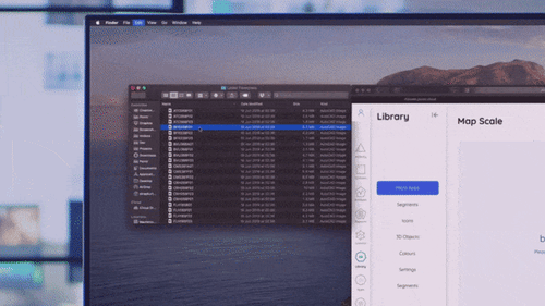
Pointr MapScale®:
The first digital mapping platform available at scale.
Why don’t Google Maps or Apple Maps support indoor maps with navigation?
While Google and Apple do offer some support for indoor maps for locations and businesses that have sought it out, one question that gets asked frequently by members of the public is why these two companies are unable to route you, for example, from your home to a specific shop within a shopping mall.
The answer is two-fold. Firstly, as discussed above, creating accurate and up-to-date indoor maps is hard and time-consuming. While a huge number of outdoor maps have been produced and developed over the years, indoor mapping remains much harder and requires the location in question’s involvement.
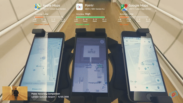
Secondly, Google Maps and Apple Maps both rely upon GPS in order to ascertain a user’s location and offer them guidance to a destination. Because GPS signal becomes substantially weaker when indoors (as explained in our post covering everything you need to know about GPS indoors), it’s unreliable and the accuracy it does offer is rarely adequate in an indoor environment where, particularly when wayfinding, every meter counts.
Who can benefit from indoor maps?
Everyone! In our experience across dozens of countries and installations ranging from healthcare facilities to airports to retail locations and more, there is no limit to the number and range of use cases we’ve encountered.
|
Want to learn everything there is to know about indoor mapping? Download our guide.
|

For customer-facing businesses such as retail locations, indoor maps are invaluable in enhancing user experience, helping people find what they’re looking for in a swift and efficient manner. For locations such as healthcare facilities and hospitals, indoor maps are twinned with asset tracking in order to enable healthcare staff to locate vital healthcare equipment efficiently and ensure they provide optimal support and care for patients. Elsewhere, in locations such as airports, both customers and staff can benefit from indoor maps; customers will be aided in finding their way in a large and likely unfamiliar area, while airline staff are able to alert customers to a change in departure gate.
What sets Pointr’s indoor mapping solution apart?
At Pointr, we’ve worked tirelessly to overcome many of the major obstacles to indoor mapping outlined above. While we’re continuing to iterate and improve all the time, we’re extremely proud of our mapping solutions and what they’ve brought to dozens of different businesses.
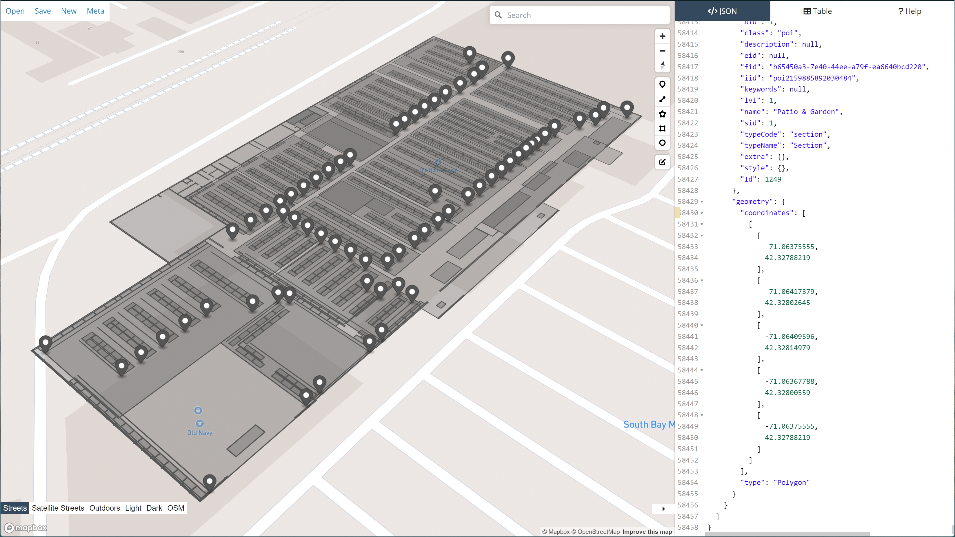
Our maps are frequently cited by our customers as striking the perfect balance between simplicity and detail, being easy to use and clear yet providing intricate levels of detail, including multiple floors, outdoor areas, and points of interest that are customizable and interactive. Exciting updates in the pipeline for Pointr Maps is the introduction of 3D maps, providing a whole new dimension of immersion.
As discussed above, one of the major hurdles to launching a successful indoor mapping campaign is the amount of time it takes to produce the maps themselves and then keeps them up to date as the indoor environment the maps cover changes and evolve. This is where Pointr’s MapScale® solution comes in.
MapScale® works with numerous different file formats and converts them into a beautiful Pointr indoor map in seconds, without the need for laborious manual work or on-site visits. Key points of interest can then be added via the Pointr dashboard. MapScale® is capable of performing the same task across thousands of different venues in seconds.
What’s more, making updates to the maps once they’ve been created is a seamless process, and is possible via either simply re-scanning the mapping files, or via our dynamic drag and drop tool that enables building managers to make quick updates to map layouts with minimal effort.

Related topics: